RTLS system mainly takes advantage of sensors, wireless communication and cloud computing technology to determine the location of “objects” with tags. Authorized users are able to access the location data of tagged objects through a local computer and cloud platform in applications like tracking goods, vehicles, people, pets, etc. This article brings you a clear understanding of RTLS!
1. What is RTLS?
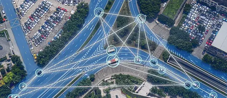
A real-time locating system mainly takes advantage of sensors, wireless communication and cloud computing technology to determine the location of “objects” with tags. Authorized users are able to access the location data of tagged objects through a local computer and cloud platform in applications like tracking goods, vehicles, people, pets, etc.
RTLS is applicable to various application scenes covering logistics supply chains, objects and people. However, the system has some limitations. For instance, devices deployed in remote areas require power reserves that can ensure months of stable operation; Fast-moving devices in transportation hubs or production lines require higher update rates; and when it comes to high-value asset tracking, security is of great importance.
2. How Teal-Time Locating System Works
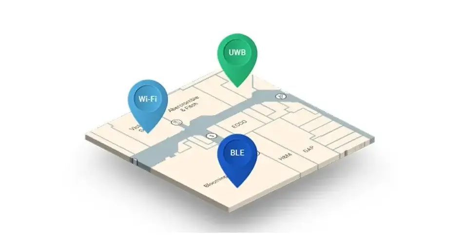
RTLS is a signal-based system that locates objects or people through radio technology. It can be categorized into active RTLS and passively-inductive RTLS. The active RTLS can be divided into AOA, TDOS, TPA, TW-TOF, NFER, etc.
1. Bluetooth RTLS
Indoor technology with Bluetooth takes use of Bluetooth LAN access points installed indoors to keep the network as a basic network-connected model based on multiple users and ensures that Bluetooth LAN access points remain the chief device of this micro-network. Then it triangulates the newly-added blind nodes through the strength measurement of the signal.
Currently, there are two major ways of locating using Bluetooth iBeacon: RSSI-based one and fingerprint-based one, or a mixture of the two.
2. WiFi RTLS
There are two types of positioning technologies with WiFi. A type is to triangulate a person and cars more precisely by a different algorithm through wireless signal strength of a mobile device and 3 wireless network access points. Another type is to record signal strength of many confirmed position points in advance and then decide the position by comparing signal strength of the newly-added devices with the database that is full of data.
Advantages: High overall precision, low cost for hardware as well as high transmission rate; It is applicable to perform complex and wide-range positioning, detection and tracking tasks.
Applicable areas: WiFi locating can be used to locate people or vehicles and used in different cases which require locating & navigation like medical centers, a theme park, plants, shopping centers, etc.
3. RTLS RFID
RFID refers to a wireless communication technology that can locate special objects and read related data through RF without mechanical or optical contact between the system and the special objects.
RFID indoor locating technology utilizes RF way to fix antennas to tune radio signals into electromagnetic fields. Then the tag that is attached to items enters into the field after induction current generation to transmit data out to exchange data among multi-pair of two-way communication so as to achieve identification and triangulation.
The radio signal is the electromagnetic field tuned to RF, transferring data from tags attached to objects to automatically determine and track it. Several tags gather energy from electromagnetic fields emitted by the identifier without batteries in the identification process. Some tags are equipped with different power supplies and are able to emit radio waves in an active way(tuned to RF electromagnetic fields).
The tags, which are included with information that is stored electronically, can be identified within several meters. Different from bar codes, the RF tags can be embedded within tracked objects with no need to be in the range of identification machines.
4. Zigbee RTLS
ZigBee (a low-power LAN protocol based on IEEE802.15.4 standard) indoor positioning technology creates a network between several to-be-measured nodes and reference nodes and gateways. The to-be-measured nodes in the network send broadcast messages and collect data from each neighboring reference node. Then it chooses X as well as Y coordinates of reference nodes that have the strongest signal. After that, the coordinates of more nodes associated with reference nodes are counted. Ultimately, data in the locating engine is operated and the offset value of nearest reference nodes is viewed to acquire the real location of nodes to be measured in large networks.
5. UWB RTLS
Ultra-wideband (UWB) positioning technology is a new technology that differs significantly from traditional communication and positioning technologies. It utilizes pre-arranged anchored as well as bridged nodes with given locations to form connections with newly-added blind nodes. Then it triangulates or locates them with “fingerprints” to identify the location.
Recently, Ultra-wideband wireless (UWB) technology has become an indoor wireless locating technology proposed with high precision. Its time resolution can be reached to nanosecond level. Combined with the time-of-arrival-based ranging algorithm, it can theoretically achieve centimeter-level positioning precision, which can meet the positioning requirements of industrial applications.
6. Infrared RTLS
There are two kinds of infrared indoor locating. The 1st one represents the target is positioned using infrared IR markers as moving points, emitting modulated infrared rays, which are taken by optical sensors installed in rooms for locating; the 2rd one is to cover the space to be estimated by several pairs of transmitters & receivers weaving infrared network to directly determine moving targets.
7. Ultrasonic RTLS
Ultrasound locating technology is developed according to the ultrasonic ranging system. It consists of several transponders and main rangefinders. The working process is: chief rangefinders are put on an object to be measured and transmit radio signals to transponders in a fixed location, and transponders transfer ultrasonic signals to chief rangefinders after taking the signal, which can help determine the location of the objects using algorithms such as reflective-ranging method and triangulation.
8. iBeacon RTLS
iBeacon Positioning
Equipped with Bluetooth 4.0, iBeacon is a new indoor micro-location technology. It is currently available for iOS, Android, Windows and Blackberry devices, all of which are embedded with Bluetooth Low Energy (BLE) technology. When your handheld device gets close to an iBeacon base station, the device is able to acquire the iBeacon signal (UUID and RSSI), which can range from a few millimeters to 50 meters, and the precise location can be obtained through a weighted three-loop positioning algorithm normally reaching 2m precision.
3. The Challenges of RTLS

Given that RTLS has effective tracking of IoTs devices, why not install positioning functions for each one? The main reason lies in the costly traditional GPS technology used for geolocation, certain technical challenges of the successful deployment and higher power consumption for its operation.
1. RTLS Cost
How long does a set of solutions system take on gathering the location of devices? Whether the locations are collected daily or every minute? The device collection frequency is directly linked to cost and battery life. In many circumstances,
traditional GPS technologies are incapable of satisfying the user’s needs in these two fields.
2. Battery Life
The power consumption of traditional GPS positioning modules is exceedingly high. Also, the module battery has to be changed multiple times each year. In certain cases, asset trackers are installed in some locations that are hard to conduct maintenance or installed inside fleets. Such deployment gives rise to the extremely high cost of changing batteries. In particular that if thousands of trackers are deployed on the field, the change of battery will be time-consuming and effort-consuming.
3. Maintenance at the later stage
Device maintenance and even massive repairs are indispensable since several IoT devices have a lifespan of 5 years, 10 and even 20 years. However, connected devices can be “lost” if they fail to send notifications or change ownership of the business due to a depleted battery.
4. Installment
It will be easy to make mistakes when deploying IoT devices. For instance, it will be prone to errors when you assemble a sensor into a building manually. What’s more, the positioning module can be transferred from one place to another without updating the tracking logs manually.
4. Benefits of RTLS
People will first think of GPS when mentioning positioning locating systems. The GNSS-based (Global Navigation Satellite System) satellite positioning has become ubiquitous. However, satellite positioning has its key drawback, that is, signals can not penetrate into buildings to realize indoor positioning.
So, how to tackle the issues concerning indoor locating?
With the constant growth of demands in the indoor positioning market, wireless communication technology, sensor identification technology and big data interconnection technology, solutions are on the rise. The industry chain continues to develop.
Indoor positioning can be divided into consumption-based and industry-based locating.
The consumption-based positioning can mainly be applied in commercial functions like indoor personnel guidance, consumer push, security monitoring, smart home, etc;
The industry-based one can be used in fire protection safety, personnel monitoring, equipment guidance, property security, smart factory, and intelligent construction sites and so on.
Indoor positioning with Bluetooth
Strengths: compact device, short distance, low power consumption, easy integration into mobile devices like a cell phone;
Drawbacks: Bluetooth transmission is not affected by sight distance, but for the complex space & environment, the less stable Bluetooth system, high noise interference, expensive Bluetooth devices;
Indoor positioning with WiFi
Strengths: relatively high overall precision, low cost for hardware, high transmission rate; can be used for large-scale positioning, detection and tracking tasks.
Drawbacks: short transmission distance, high power consumption, and generally with star topology structure.
Indoor positioning with RFID
Advantages: RFID indoor positioning technology works at a very close distance but it is able to gather centimeter-level positioning accuracy information in a few milliseconds; The tag is relatively small in size and low in cost.
Drawbacks: no communication capability, poor anti-interference ability, no easy integration into other systems and under-developed protection of security & privacy and global standardization of users.
Indoor positioning with Zigbee
Benefits: low power consumption, cost-saving, short delay, large capacity and high security, long transmission distance; be able to sustain structures of mesh topology, tree topology as well as star topology, adaptable networking, multi-hop channeling;
Disadvantages: low transmission rate, high algorithm requirements for positioning precision.
Indoor positioning with UWB
Advantages: with GHz bandwidth, high positioning accuracy; strong penetration, good anti-multipath effect and high security.
Shortcomings: But the newly added blind nodes also need active communication making the power consumption higher, and the system is costly
Indoor positioning with infrared
Advantages: high precision for indoor locating, powerful anti-interference capability;
Drawbacks: Infrared can only be transmitted by sight, poor penetration performance; when the tag is blocked it can not function properly but be vulnerable to lighting, smoke and other environmental factors;
Indoor positioning with ultrasound
Advantages: high overall positioning precision, reach the centimeter level; relatively simple structure, good penetration ability as well as a strong anti-interference ability for the ultrasound.
Disadvantages: large attenuation in the air, inapplicable to large occasions; it is greatly affected by multipath effects and non-visual propagation when measuring reflection distance, resulting in a high cost of investment when requiring bottom hardware for precise analysis and calculation.
5. What technologies are used in RTLS
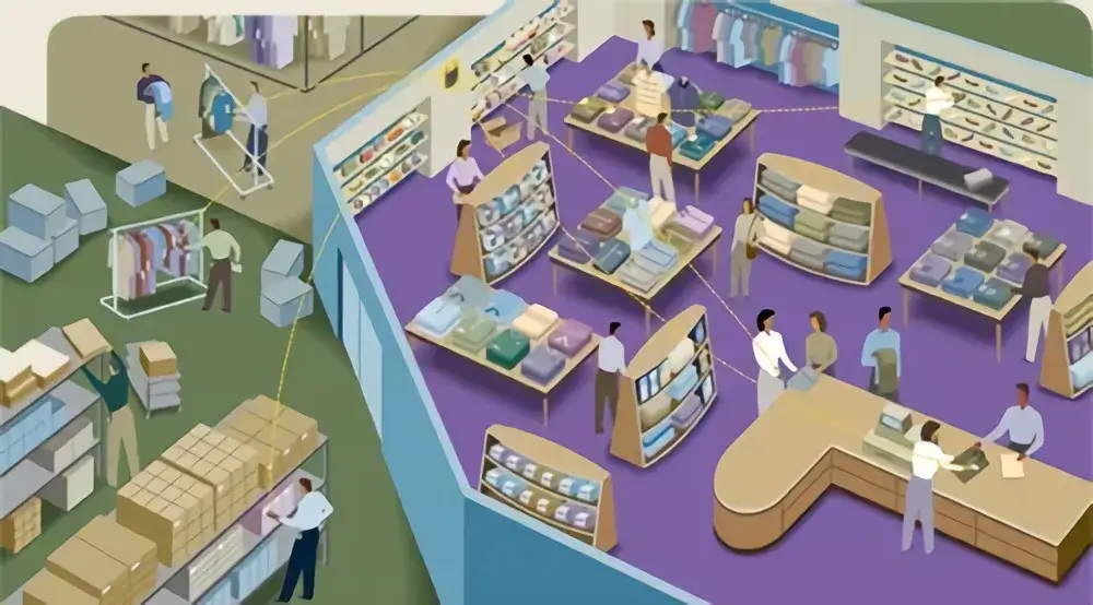
RTLS technology
RTLS typically is comprised of three parts: the RTLS tag, infrastructure as well as software. The performance and function of the solutions rely on the specific technology choices made during the RTLS solutions development process.
Using RFID technology, RTLS systems determine the location of “objects” with tags as it passes near a fixed reader, and then send information about the event to a server.
Bluetooth RSSI, also Received Signal Strength Indicator, is applicable for RTLS in indoor scenes. A Bluetooth beacon deployed in the monitored area “monitors and listens” to the signal from the Bluetooth tag to determine if the tagged object or person locate within the coverage of the Bluetooth signal, so as to provide “room-level” positioning precision.
Similar to Bluetooth RSSI, Wi-Fi beacons can be applied to detect nearby Wi-Fi RTLS tags, providing “room-level” accuracy. Or, time-of-flight methods can be used to provide a more accurate location of mobile assets.
Cellular 3G and 4G LTE technologies provide rough locating information based on cellular network fingerprinting, where equipment detects nearby cellular base stations and compares them to the worldwide fingerprint database that has established geographic location mappings. Featuring higher precision, 3G and 4G LTE real-time tracking solutions depend on different mixtures of immobile and mobile network infrastructure, with more solutions to emerge as the number of 5G deployment increase rapidly.
GNSS-based RTLS systems are dependent on GNSS receivers which define their locations through the measurement of the time it spends on the GNSS satellite signal to approach them from orbit. Because of weak GNSS signals, they cannot penetrate walls and buildings so only be used outdoors.
Ultra-wideband technology and Bluetooth indoor positioning with high precision are two technologies that are able to offer sub-meter level positioning precision.
An RTLS tag is possible to cover additional sensors to collect additional messages about the asset being tracked. Positioning modules with inertial sensors can detect when an asset is dropped or supplement satellite-based positioning when GNSS signals are lost. Likewise, temperature sensors detect temperature excursions that are possible to spoil sensitive cargo.
To offer location data to users, RTLS require a data pipeline connected to the Internet. Outdoor real-time tracking solutions, including GNSS-based solutions, provide excellent services for certain cellular communication improved through low power consumption as well as max coverage like LTE Cat 1 or LTE-M.
6. The Application of RFID in RTLS

RTLS has been well-developed in many examples, and the number is estimated to increase rapidly in the following years since the technology changes to be precise, more accessible and to form tighter integration into operations.
RTLS Healthcare / Medical
Staff in hospitals spend a significant portion of time on locating medical equipment, which puts additional strain on an already strained system. RTLS in hospitals is conducive to quickly locating beds and medical devices and may also help locate doctors, staff and patients.
Warehouse automation
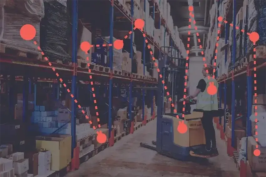
RTLS system is useful to automatically manage inventory and locate goods on shelves.
Transport and logistics
Real-time locating services give enterprises a deep understanding of all aspects related to the process of supply and distribution. Apart from the improvement of supply chain management, companies can also use data provided by RTLS to alleviate bottlenecks and simplify its procedure as well as monitor remotely the process of their goods, thus boosting the product quality.
Management of fleet
RTLS can give hands to fleet managers to track their vehicles, including trucks, cabs, cars, shared ones, etc. Micro-mobile solution providers(such as those who supplies shared electric scooters) have increased their use of highly precise RTLS technology to force themselves to abide by local regulations such as bans on driving on sidewalks.
Transportation hub
Transportation hubs including an airport and train station can track luggage trailers, passengers with particular demands, ground personnel and other passengers through Real-Time Locating System technology. Data collected from the technology can be analyzed to detect and tackle operation problems and improve the overall travel experience.
7. RTLS Solutions
U-Blox has always conducted innovative R&D based on GNSS positioning algorithms, the RF and signal processing technologies since its founding in 1997. Nowadays, it has been dedicated to developing integration solutions on “cloud-on-a-chip”, which has enabled itself to take the lead in technological innovation. U-Blox has also grown into a company with deep market insights which allow itself to precisely understand markets and users’ needs.
In addition to providing GNSS positioning solutions, U-Blox has a good grasp of the increasing demand for device communication and indoor positioning from IoT users. Therefore, u-Blox has not only extended its product line of cellular communication and short-range communication but also provided the market with a mixture of modules that can achieve both GNSS positioning and cellular communication functions to help users come up with compact RTLS solutions.
With the rapid growth of big data and smart connectivity technologies, u-Blox is not satisfied with being a hardware provider of location and communication technologies. The company is considering how to leverage services to maximize the business value of location information in IoT devices and provide one-stop services to customers through a “hard and soft” approach to empower customers in various fields to achieve rapid RTLS deployment.
AssistNow decreases power consumption by shortening the first positioning time using GNSS.
when GNSS signals are not available, CellLocate can still conduct rough locating using cellular network fingerprinting technology.
CloudLocate calculates location via the cloud for application scenes requiring ultra-low power consumption where continuous tracking is not required.
PointPerfect provides GNSS-enhanced data services for centimeter-level positioning precision in seconds.
U-Blox Thingstream supports customers to tackle complex challenges of IoT connectivity with an extensive end-to-end solution according to the industry standard MQTT. This enables customers to transfer data from IoT equipment to the cloud of companies without additional communication carrier fees.
Additionally, U-Blox IoT “Security as a Service” brings the “end-to-end” concept to real life based on unique and immutable device identity and a reliable root of trust. It effectively stops sensitive data from being disclosed at intermediate nodes, platforms and services to ensure that your RTLS tags and other infrastructure only operate actual firmware and that the data generated during the operation is only visible to its target users.
8. What are the well-known RTLS companies
Siemens RTLS
Versus Technology
Ubisense Group
AiRISTA
Zebra Technologies
BeSpoon
Axcess International
Stanley Healthcare
Essensium
Savi Technology
TeleTracking
Sonitor Technologies
TimeDomain
Identec Solutions
Intelleflex
GE Healthcare
Awarepoint Corporation
Elpas
Ekahau
IBM
CenTrak


