This article highlights everything about outdoor positioning technology. GPS, Beidou, GLONASS, GALILEO, and other global positioning and navigation systems are the mainstays of outdoor positioning technology. In contrast, Bluetooth Beacon, wifi, UWB, and other wireless technologies are the basic foundations of indoor positioning technology.
1. The definition of outdoor positioning technology
The two primary categories of outdoor positioning technologies at this time are GNSS positioning and LBS positioning.
Location LBS
Base station positioning, or LBS positioning, uses a network of mobile telecom carriers to determine the location information of users of mobile terminals (such as GSM networks, GPRS, etc.).
Positioning tenet: Indoor positioning is comparable to the concept. Users will first search all neighboring base stations once they launch the location function. Naturally, the distance from each base station varies, as does the signal strength received at that distance. You can use the three-point positioning method to get an approximate position when the received base station is more significant than or equal to 3. The location accuracy is roughly several hundred meters due to the signal’s volatility. However, because of the base station’s location value, the power used by the base station’s motion is not too much. (Scanning base stations uses energy, of course.)
GNSS
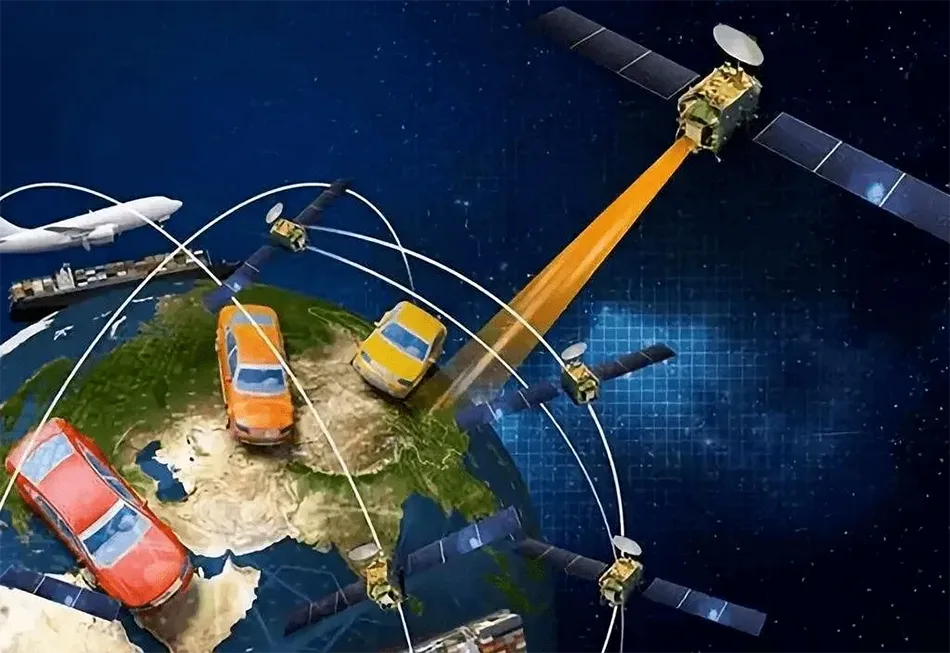
Global Navigation Satellite System, or GNSS, is an acronym for the US GPS, China’s Beidou Navigation Satellite System, Russia’s Glonass, Europe’s Galileo, and other satellite navigation systems.
Three components comprise the GPS global positioning system: the user equipment, the ground control, and the space component.
Twenty-four satellites make up the space segment, which is positioned so that every location on Earth may receive signals from all four satellites.
The monitoring station, central control station, standby main control station, and information injection station make up the ground control component, which controls the satellite and ensures that it operates normally.
The receiver component is part of the user equipment to get satellite-provided ephemeris information.
GPS Positioning Concept
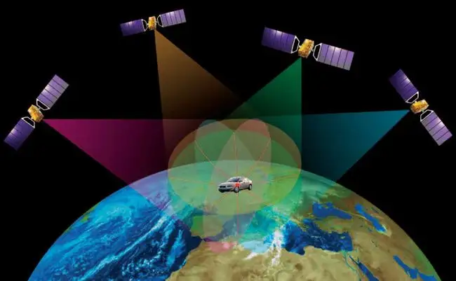
The satellite’s position and distance can determine the receiver’s location.
A satellite at the same distance from Earth appears as a circle. Then, three satellites might theoretically achieve positioning.
2. Outdoor positioning’s operational principle
Global Positioning System (GPS)
LBS stands for location-based services, which are cell phone-based tracking systems. It is a satellite- and radio-based tracking and navigation system. The system can determine the geographic coordinates of things or persons on the surface of the Earth as long as it has a piece of equipment with a GPS receiver. A GSM cell tower from a nearby mobile phone service provider is used for tracking.
Location LBS
Because it is located using a mobile phone, LBS placement has the convenience benefit of extending the device’s standby period and reducing energy consumption. Calculating the difference between the signals from three base stations should theoretically allow one to pinpoint the location of a phone. Therefore, regardless of the weather, you can always locate tall buildings, places, or other conditions, on the user’s gadget as long as it is within the mobile communication network’s practical range.
3. What methods of outside positioning are employed?

GPS location
A satellite in the sky can send signals to a phone’s GPS, which can then use those signals to determine the current longitude, latitude, and height. GPS positioning accuracy is generally relatively high in broad, plain areas.
Base station placement
The carrier’s telecom base station positioning is the foundation for base station positioning. Typically, three base stations are required to locate a plane and identify its location based on the received signal intensity. These base stations make it more reliant on the telecom base station density, and more distribution means more accurate placement.
Hybrid approach
Wifi data and base station location are combined to form a hybrid site. This combination explains how the wifi location functions. When a phone connects to wifi, the manufacturer logs both the physical address and the wifi’s MAC address so that the phone can locate that address the next time the user connects to wifi. Mutual verification can be realized when more wifi is available, and the supplier has more data recorded.
4. What is the purpose of the outdoor positioning system?
What are some uses for GPS?
The uses of GPS will be very diverse. You can use GPS signals for time transmission, speed measurement, geodetic and engineering survey precision positioning, missile guidance, and land, air, and sea navigation.
For you to achieve rapid aerial survey mapping with little or no ground control, it is necessary to know the camera’s position at the time of aerospace photography. This technological advancement brought about the development of geographic information systems and global environmental remote sensing monitoring.
For more effortless fulfillment of fleet management demands, some GPS receivers incorporate radios, wireless phones, and mobile data terminals, primarily for positioning navigation of ships, automobiles, aircraft, and other moving things. In addition, many companies and government organizations track the whereabouts of their vehicles using GPS devices, frequently using wireless communication technologies. Such as:
- Ship navigation in open waters and water diverted into ports
- Route guidance, approach, and landing for aircraft
- Autonomous vehicle navigation
- Urban intelligent traffic management and ground vehicle tracking
- Immediate life-saving
- Individual excursions and wilderness exploration
- A portable communication device (integrated with PDA and electronic map)
- Power, post, and telecommunications network time synchronization
- Precise timing
- Reliable input of frequency
- Controlled geodetic surveys of all grades
- Overcrowding of highways and different routes
- A topographic study was conducted underwater.
- Crustal deformation measurement, DAMS, and significant building deformation monitoring
- The GIS program
- Control of construction equipment (tire cranes, bulldozers, etc.)
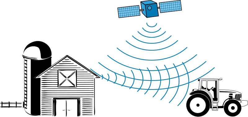
- Exquisite agriculture
The core component of a vehicle GPS positioning management system is autonomous vehicle GPS positioning, which is integrated with a wireless communication system for scheduling and tracking vehicles.
Putting the base station in place
The indoor or outdoor positioning system primarily uses the positioning base station. The positioning base station, which is comparable to the wireless AP in WIFI and uses the positioning technology principle of the base station, is primarily employed in the communication and positioning algorithm of positioning cards in the personnel positioning system.
Application scenarios for dual-frequency high-precision location base stations include personnel positioning systems for prisons, detention facilities, and psychiatric hospitals.
Public inspection and law enforcement agencies, schools, hospitals, factories, tunnels, mines, and other locations that require the positioning of people, objects, and vehicles frequently use UWB positioning systems. These applications often call for the construction of locating base stations in positioning contexts. For instance, base stations for fuzzy positioning systems must be set up. The area positioning system must find the base and anchor base stations. According to the AOA, the high-precision positioning system must discover the base station and beacon, and the UWB positioning base station must be established for the ultra-precision positioning system.
5. The outdoor locating system’s accuracy
Base station with dual frequencies and high precision location
The dual-frequency high-precision positioning base station’s primary functions are: Mostly 2.4G+125 dual-frequency positioning, positioning accuracy of 0–5 meters, with a battery life of 1–5 years for the positioning card or wristband;
GPS location precision
GPS positioning output is one time per second; following CPU processing, transmission to the center is typically 30 seconds per point; the transmission time is relatively brief and is GPRS Internet time. GPS positioning accuracy is typically 15 meters or less.
Location LBS
Mobile devices using LBS have a location inaccuracy of 50 to 5,000 meters.
LBS base station positioning, also known as Location Based Service (abbreviated LBS), is a location-based service typically used by mobile phone users. With the aid of a GIS platform, it employs telecommunication, the radio communication system of mobile carriers or an external positioning method to obtain the location data of mobile terminal users. It is a premium service that offers users comparable services.
6. Drawbacks of outdoor placement
GPS satellite positioning drawbacks
Navigation messages include; satellite ephemeris, operational conditions, clock correction, ionospheric correction, and atmospheric refraction correction. However, in addition to the user’s 3D coordinates X, Y, and z, since the user receiver’s clock is not always synchronized with the satellite’s on-board clock,
The time difference between the satellite and the receiver, or variable T, is also added as an unknown. We next utilize four equations to solve these four unknowns.
As a result, to locate the receiver, you must be capable of getting signals from a minimum of four satellites.
Despite its great precision and extensive coverage, satellite positioning is not appropriate for all customers due to its high cost and power consumption.
Base station location drawbacks
It is intrinsically known that the positioning of the base station is imprecise because its signal is easily obstructed when located. Since the precision is only approximately 150 meters, driving navigation is essentially impossible.
The mobile phone must be in an area with a base station signal, register the sim card, and detect the movement of three ground stations, whether indoors or outside.
The primary application is to quickly determine your location when there is no GPS or wifi because positioning is done exceptionally quickly once a signal is found.
7. Benefits of outdoor positioning
Base station location benefits
The idea behind the base station location is also straightforward: based on the signal strength received by phone, we can roughly estimate how far away the base station is from you. We know the signal gets worse the further you are from the base station.
The phone can roughly calculate the base station’s distance by simultaneously detecting the signals of at least three base stations, which is pretty straightforward given today’s network coverage.
The three-point positioning entire states that all that is necessary to calculate the separation between three ground stations (three points) and a phone is to continually sketch a circle with the base station’s location as its center and the distance from the telephone as its radius.
The positioning of the device is where these circles connect. It’s because the base station is unique in the mobile network, and its geographic location is also excellent.
Benefits of GPS location
- All-weather positioning on a global scale: Due to the vast and evenly distributed number of GPS satellites, it is possible to see at least 4 of them at any given time from any location on Earth. This possibility enables the provision of continuous global all-weather navigation and positioning services (except for thunder and lightning should not be observed).
- Excellent positional precision. Within 50 km, GPS relative positioning precision can approach 10-6 m, 100–500 km, 10-7 m, and within 1000 km, 10-9 m. When more than an hour of observation is made during the precise positioning of the 3001500m projects, the plane position error of the solution is less than 1mm, which is comparable to the ME-5000 electromagnetic…
- A brief observation period: With the ongoing development of the GPS, relatively static positioning within 20 km only takes 15-20 minutes; when each mobile station and the reference station are within 15 km of each other, the mobile station’s observation time is only required 1-2 minutes. When real-time dynamic positioning is used, observing each station takes a few seconds.
- Communication between test sites is not required. GPS surveys don’t need to see the surveying stations; all that is needed is a clear sky. A survey beacon is thus no longer required.
8. Best outdoor location service providers
- Qualcomm
- Microsoft
- Samsung
- Cisco
- Apple
- Below Holdings
- Hewlett-Packard (HP)
- INSITE
- AeroScout


NB-IoT Applications, Solutions and Use Cases")


