BeiDou-satellietnavigatiesysteem (kortweg het BeiDou-systeem) is een mondiaal satellietnavigatiesysteem dat onafhankelijk door China is opgezet en geëxploiteerd om te voldoen aan de eisen van de nationale veiligheid en de groei van de economie en de samenleving. Het functioneert ook als een cruciale nationale ruimte-tijdinfrastructuur die onder alle weersomstandigheden kan functioneren, altijd, zeer nauwkeurige lokalisatie, navigation and timing services to users around the globe.
This article gives you a comprehensive picture of the BeiDou satellite navigation system.

The BeiDou satellite navigation system refers to the worldwide satellite navigation system studied and invented by China. It is also the third well-developed satellite navigation system after the birth of GPS as well as GLONASS. The BeiDou satellite navigation system, Global locating System from the United States, GLONASS from Russia as well as GALILEO from the European Union have been qualified suppliers which have been recognized by the United Nations on Satellite Navigation.
In het algemeen, a navigation system contains a collection of basic functions, including “locating”, “destination selection”, “route calculation” and “route guidance “. Bovendien, the system supports color map display in its higher performance series. All these functions require a digital map of the road network, which is often stored on a CDROM.

The BeiDou Satellite Navigation System is comprised of 3 components covering space, the ground and the users. The part of space consists of a certain amount of the geostationary satellite, the inclined geosynchronous orbital satellite and the medium circular earth orbital satellite. The section of the ground covers a lot of ground stations including master control stations, time synchronization & injection stations and monitored stations, as well as inter-satellites linked operations and managed facilities. The user part is composed of basic items such as a chip, een module en antennes van het BeiDou-systeem dat compatibel is met andere satellietnavigatiesystemen, en eindartikelen, het toegepaste systeem en de toegepaste diensten.
Momenteel, het BeiDou-systeem functioneert soepel, en de serviceprestaties van het BeiDou-systeem zijn wereldwijd geëvalueerd en getest. De prestaties bestrijken gebieden zoals de globale lokalisatieprecisie die beter is dan tien meter, De nauwkeurigheid van de snelheidsmeting is beter dan 0.2 meter per seconde, timingprecisie is beter dan 20 nanoseconden en de beschikbaarheid van diensten is beter dan 99%. De prestaties van de regio Azië-Pacific zijn zelfs nog verbeterd.
3. De korte introductie van de BeiDou-1, Beidou-2 evenals de BeiDou-3

Het BeiDou navigatiesatellietsysteem
Het is een navigatie-lokalisatie- en communicatiesysteem en onafhankelijk opgezet door China, the BeiDou Navigation Satellite System represents the first generation of regional and three-dimensional satellite system with a source-tracking function. The system is comprised of 23 Earth-synchronized satellites, one central control station, multiple target calibration stations and a lot of user units. With the integration of the benefits of traditional astronomical navigation and locating as well as ground radio navigation and locating, the system creates a radio navigation station equivalent to the one set up in space.
The system can accomplish two-way message communication, and the communication data is primarily composed of two types: Chinese characters and codes. It is capable of identifying the geographical latitude, longitude as well as altitude for users at any time and any place, mainly offering navigation, lokaliseren, evenals de timing voor de openbare veiligheid, snelweg verkeer, spoorwegvervoer en maritieme activiteiten op het grondgebied, territoriale wateren en aangrenzende gebieden van China. Bovendien, Er worden ook communicatiediensten voor korte berichten verschaft tussen gebruikers en tussen gebruikers en het centrale controlestation.
De BeiDou-2 navigatielokalisatie Satelliet systeem
Het BeiDou-2 navigatie-lokalisatiesatellietsysteem(BD2 of BeiDou-2) is een wereldwijd satellietnavigatiesysteem dat onafhankelijk is onderzocht en ontwikkeld door China. De BeiDou-2 is niet zomaar een uitgebreide versie van de BeiDou-1. In plaats van, het is een geoptimaliseerde versie geweest, gebaseerd op de nadelen van de BeiDou-1, het aanbieden van wereldwijde navigatielocatiediensten voor allround gebieden, inclusief het land, zee en lucht. It bears the similar functions of GPS in the United States and the Galileo satellite navigation system from the European Union. On April 30, 2012, China successfully launched “one rocket and two satellites” at the Xichang Satellite Launch Center. The twelfth and thirteenth BeiDou Navigation System satellites were successfully launched into the scheduled transfer orbit by a Long March 3B carrier rocket.
The third generation of the BeiDou Navigation Locating Satelliet systeem
The BeiDou-3 global satellite navigation system (the BeiDou-3 system for short) is comprised of 24 medium circular Earth orbit satellites, three geostationary orbit satellites and three inclined geosynchronous orbit satellites, a total of 30 satellieten.
The BeiDou-3 satellite navigation system supports 2 kinds of services, which is called the open service and the authorized service. The opened service functions as supporting free locating, speed measurement as well as time services in the service field with locating precision of ten meters, timing precision of 50 nanoseconds and speed measurement precision of 0.2 meter per seconde. The Authorized service functions by offering safer locating, speed detection, time and communication services and systematic integral information to the authorized user.
4. The application cases of the BeiDou System

Smart Driving
By using the 5G plus BeiDou locating system with high precision, a user is unnecessary to set up his or her own basic calibration stations. The user can acquire the national locating services with high precision with only an account or an SDK.
The vehicle-grade MU plus GNSS is equipped with tightly coupled solving algorithms to guarantee the constant locating of vehicles in complicated environments such as tunnels and urban canyons. 5G network high-bandwidth and low latency technologies are utilized to realize differential data interaction between vehicle equipment locating terminals and high-precision locating networks to guarantee high-precision location data security.
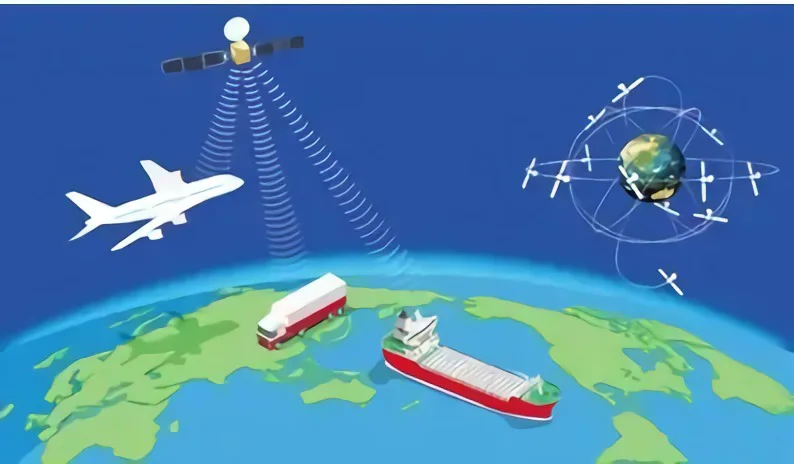
Intelligent Port and Shipping
In de afgelopen jaren, China’s shipping industry has achieved rapid growth but labor costs continue to soar and operational safety still needs to be improved.
The BeiDou system with 5G plus technology is able to support all-rounded as well as all-weather dynamic and static locating services in a precise and accurate manner for port and navigation scenarios such as port machines, verzamel vrachtwagens, personeel, bakens, schepen en sluizen om de operationele efficiëntie te vergroten, veiligheidsniveau en kwaliteit van de dienstverlening van de haven- en navigatie-infrastructuur. In verschillende soorten haven- en navigatieproductieverbindingen worden zeer nauwkeurige lokalisatiesystemen geïnstalleerd, die aanvaringsrisico's en afwijkingsrisico's redelijkerwijs kunnen monitoren en beheersen. 5G-netwerken kunnen worden gehuurd om real-time contacten en verbindingen tussen het afgelegen centrum en de haven- en maritieme operatielocaties te realiseren, het garanderen van de tijdigheid en nauwkeurigheid van de verzending van apparatuurberichten.
SMart Logistiek
Inspectierobots, logistieke voertuigen, cloud-AGV's, high-definition videocamera's en andere apparatuur in het logistieke proces kunnen worden aangesloten op de 5G-privénetwerken om tot op centimeterniveau nauwkeurige en nauwkeurige lokalisatie te bereiken met behulp van China Mobile's 5G-netwerken, het uiterst nauwkeurige lokalisatiesysteem BeiDou en een ruimte-tijd-informatieplatform.
2.6G-band 5G-basisstations kunnen end-to-end servicelatentie garanderen en logistieke activiteiten met meerdere segmenten realiseren voor logistiek-specifieke bedrijfsscenario's om de veiligheid te garanderen, privacy, hoge snelheid en betrouwbaarheid van het eigen monitoringnetwerk. Er wordt een intelligent logistiek platform opgezet met meerdere toegangen, end-to-edge samenwerking in de cloud, videonetwerken, en kunstmatige intelligentie verbeteren met behulp van big data-analyse en clouddiensten.
SMaart-bus
Geïnstalleerd met terminals zoals intelligente rijcontrollers, BeiDou uiterst nauwkeurige lokalisatie in de bus, Er kan nauwkeurige en nauwkeurige informatie over de locatie van voertuigen worden verkregen om diepgaande begeleidingsstrategieën te ontwikkelen ter ondersteuning van functies zoals energiebesparing van voertuigen en veilige doorgang in en uit stations en oversteekplaatsen. Multifusiesensoren zoals radar en camera's worden ingezet op kruispunten om realtime fusiedetectie en informatieverspreiding over weggebeurtenissen te realiseren.
Bik delen
Momenteel, gewone satellietlocatiebepaling wordt meestal gebruikt bij het delen van fietsen. Echter, het lokalisatiesysteem kenmerkt zich door een slechte lokalisatieprecisie en stabiliteit, wat leidt tot een slechte gebruikerservaring bij het vinden en retourneren van fietsen, lage efficiëntie bij het debuggen van bedrijfsactiviteiten en onderhoud, evenals grote problemen bij afdelingssupervisie.
The high-precision locating service can enhance the locating precision of bicycles to sub-meter level and support functions such as electronic fences, trajectory tracking and security warning. Bovendien, it provides billing based on time pool to realize unified billing for large batches of bikes and offer a convenient experience for users.
Nauwkeurig & Nauwkeurige navigatie
The BeiDou high-precision locating system has been widely applicable for the areas of the fields of mass consumption, sharing economy and the livelihood of people. Onder hen, the locating precision of smartphones is around ten meters. Bovendien, there are jump points and offsets, which cannot satisfy the demands of lane-level map navigation and precise taxi hailing.

The technologies are mainly comprised of Real Time Kinematic, Precise Point Locating, the Assisted BeiDou System, het BeiDou grondgebaseerde augmentatiesysteem en het BeiDou satellietgebaseerde augmentatiesysteem.
Realtime kinematisch
RTK, of realtime kinematisch, kent de volgende werkingsprincipes: de ontvangers van het basiskalibratiestation en het mobiele station monitoren voortdurend de beweging van de satelliet. Het basiskalibratiestation verzendt de real-time kinematische meetwaarde naar de ontvangers van de mobiele stations en de mobiele stations realiseren tegelijkertijd de ontvangst van de waargenomen visuele satellietsignalen. Vervolgens zal het basiskalibratiestation zijn eigen realtime kinematische meetwaarde vergelijken met de ontvangen kinematische meetwaarde in realtime om de gegevens te verwerken en zijn eigen coördinaten van de ruimte te berekenen om zijn eigen zeer nauwkeurige lokalisatie te vervullen.. The differences in the locating precision between the two kinematic measurement values can reach the centimeter level.
Precise Point Locating Technology
The Precise Point Locating Technology was first proposed by the U.S. Jet Propulsion Laboratory(JPL) Zumberge in 1997. The proposal as well as the realization of the technology have laid a foundation for the growth of the Difference Augmented Technology of the Commercial Global Satellite Station that is on the basis of the real-time Precise Point Locating Technology. With the integration of the benefits of GNSS standard single-point locating and relative locating, the Precise Point Locating Technology has developed into a new GNSS highly precise locating approach.
Assisted-BeiDou Fast Locating Technology
A-BDS, also named Assisted-BeiDou Locating Technology, is capable of enhancing the performance of the BeiDou Satellite Locating System. With the aid of the mobile communication operation base station, the Assisted-BeiDou Locating Technology is able to locate objects in a fast manner. The basic working principles of the Assisted-BeiDou Locating Technology lie in setting up several referred satellite locating receivers in the positions where there are excellent receiving results of the satellite signals. With the interaction between the Assisted-BeiDou Locating System servers and the terminals, a rough position of the terminals can be obtained. Then the auxiliary data such as ephemeris and clock needed by this terminal are sent to the terminal through the mobile network, and the terminal performs the BeiDou System locating measurement. The Assisted-BeiDou Locating Technology has distinctive strengths such as short locating time, low power consumption and high sensitivity.
The BeiDou ground-based augmentation system
The BeiDou ground-based augmentation system aims to establish a high-precision satellite navigation service system that is mainly based on the BeiDou system and compatible with other satellite navigation systems. With the use of BeiDou or GNSS high-precision receivers, it enhances real-time high-precision navigation and locating services in the service area for 1-2m, decimeter and centimeter-level through a network of ground-based reference stations and the broadcasting means of using satellite, mobiele communicatie, digital broadcasting.
The BeiDou satellite-based augmentation system
The BeiDou satellite-based augmentation system remains a crucial component of BeiDou satellite navigation. Being equipped with satellite navigation augmentation signal transponders on geostationary satellites, it can broadcast ephemeris errors, satellite clock differences, ionospheric delays and other correction information to users to realize enhancement in locating the precision of the original satellite navigation system. The combination of the satellite-based augmentation system and the ground-based augmentation system are able to create a more efficient satellite navigation high-precision locating service network and set up a high-precision location service infrastructure environment for professional applications such as territorial mapping, marine survey, precisielandbouw, disaster monitoring, unmanned aerial vehicles and unmanned vehicles, as well as popular applications such as car navigation.

Global Navigation Satellite System is a general term, which is included with the four navigation satellite systems covering Global Locating System, the GLONASS system, the GALILEO navigation system and the BeiDou system. Bovendien, it also involves the MSAS system from Japan, GAGAN from India and NIG-GOMSAT-1 from Nigeria.
Daarom, GNSS functions as a star-rated radio navigation system utilizing the artificial satellite as the navigation station to provide all-weather, highly precise locations, speed and timing information for all kinds of military and civilian carriers on the land, zee, lucht en lucht over de hele wereld, which is also referred to as space-oriented locating, navigation and timing systems.
The most important feature of the “BeiDou” system lies in the close connection with navigation and communication, which is not available in other navigation systems. Bijvoorbeeld, the BeiDou system can play a crucial role in places such as deserts and grasslands, where cell phones cannot be utilized.
The BeiDou-3 system utilizes a triple-frequency signal, which is able to better eliminate the impact of the ionosphere, improve locating reliability, and enhance data pre-processing capabilities, thus greatly boosting the efficiency of fuzziness fixation.
The locating precision of the BeiDou system will be boosted to the level of 2.5 meters to 5 meter. Also with the initial service supported by the BeiDou ground-based augmentation system, it is able to support services at the meter, sub-meter, decimeter, and even centimeter levels.
7. Wat zijn de verschillen tussen GPS en het BeiDou-satellietlocatiesysteem?

The most eye-catching difference between GPS and the BeiDou satellite locating system is that GPS has not been equipped with the function of sending and receiving short text communication while the BeiDou satellite locating system supports the function of sending and receiving short text communication. Echter, it is vital to note that cell phones generally cannot support the function of sending and gathering texts of the BeiDou satellite locating system for the reason that the locating chip on the cell phones can only support obtaining locating information from satellites.
GPS maakt gebruik van een signaal met dubbele frequentie. Echter, the BeiDou satellite locating system takes use of a triple-frequency signal. Theoretisch gesproken, GPS has comparable locating precision globally while the locating precision of the BeiDou satellite system is specially strengthened for China and its surrounding areas.
GPS has actually been equipped with 32 satellieten. Hoe meer satellieten er zijn, des te meer redundante gegevens zullen worden verkregen, hoe betrouwbaarder de gegevens zullen zijn, en hoe kleiner de DOP-waarde zal zijn. Direct, the BeiDou satellite locating system has been only equipped with sixteen satellites. Hoe meer satellieten er zullen zijn, hoe meer observatiegegevens er zullen worden verzameld, en hoe onvermijdelijker de nauwkeurigheid zal worden verbeterd.
GPS is eenrichtingsverkeer, wat betekent dat de ontvanger alleen de locatiesignalen kan verzamelen en alleen weet waar u zich bevindt. Integendeel, the BeiDou satellite locating system is two-way oriented, Dit betekent dat het systeem uw positie aan uw vrienden kan doorgeven om uw vrienden te laten weten waar u zich bevindt, terwijl het ook signalen ontvangt. In het algemeen, GPS and the BeiDou satellite locating system both function as navigation and locating systems but they make use of distinctive locating technologies and therefore have different locating ranges. The BeiDou navigation system is expected to be equipped with global locating and navigation functions by 2020. Echter, GPS is een locatiesysteem voor alle weersomstandigheden dat gebieden over de hele wereld bestrijkt.
China has begun to conduct research on the technologies and plans of satellite navigation systems since 1970.
The engineering set-up of the BeiDou satellite navigation system was initiated in 1994.
Two Earth Static Orbital Satellites were launched and the relevant systems are set up to come into use in 2000. The functions like timing, and information transmission of China’s systems have been changed from the original Global Positioning System to the BeiDou satellite navigation system.
The engineering construction of the BeiDou-2 navigation system was launched in 2004.
Tegen het einde van 2012, fourteen satellites (including five geostationary orbit satellites, five inclined geosynchronous orbit satellites and four medium circular earth orbit satellites) were launched to form the relevant network. Op basis van de compatibiliteit met het technische systeem van het BeiDou-1 systeem, het BeiDou-2-systeem is toegevoegd met een passief lokalisatiesysteem om lokalisatie mogelijk te maken, snelheidsmeting, timing en communicatiediensten voor korte berichten voor gebruikers in de regio Azië-Pacific.
De technische constructie van het BeiDou-3-navigatiesysteem werd gelanceerd in 2009.
In 2018, De vorming van het Chinese BeiDou-3-netwerk was volledig voltooid.
Op juni 23, 2020, China lanceerde met succes de vijfenvijftigste navigatiesatelliet van het BeiDou-systeem, die de volledige constructie markeerde van de inzet van de Beidou-3 wereldwijde satellietnavigatiesysteemconstellatie.


