BeiDou Satellite Navigation System (the BeiDou system for short) is a global satellite navigation system that is set up and operated independently by China to satisfy the requirements of national security and the growth of the economy and society. It also functions as a crucial national space-time infrastructure providing all-weather, all-time, highly precise locating, navigation and timing services to users around the globe.
This article gives you a comprehensive picture of the BeiDou satellite navigation system.

The BeiDou satellite navigation system refers to the worldwide satellite navigation system studied and invented by China. It is also the third well-developed satellite navigation system after the birth of GPS as well as GLONASS. The BeiDou satellite navigation system, Global locating System from the United States, GLONASS from Russia as well as GALILEO from the European Union have been qualified suppliers which have been recognized by the United Nations on Satellite Navigation.
Generally speaking, a navigation system contains a collection of basic functions, including “locating”, “destination selection”, “route calculation” and “route guidance “. What’s more, the system supports color map display in its higher performance series. All these functions require a digital map of the road network, which is often stored on a CDROM.

The BeiDou Satellite Navigation System is comprised of 3 components covering space, the ground and the users. The part of space consists of a certain amount of the geostationary satellite, the inclined geosynchronous orbital satellite and the medium circular earth orbital satellite. The section of the ground covers a lot of ground stations including master control stations, time synchronization & injection stations and monitored stations, as well as inter-satellites linked operations and managed facilities. The user part is composed of basic items such as a chip, a module and antennas of the BeiDou system which is compatible with other satellite navigation systems, and terminal items, the applied system and applied services.
At present, the BeiDou system is in smooth operation, and the service performance of the BeiDou system has been evaluated and tested globally. The performance covers areas like global locating precision is better than ten meters, speed measurement precision is better than 0.2 meters per second, timing precision is better than 20 nanoseconds as well as service availability is better than 99%. The performance of the Asia-Pacific region is even more improved.
3. The Brief Introduction of the BeiDou-1, BeiDou-2 as well as the BeiDou-3

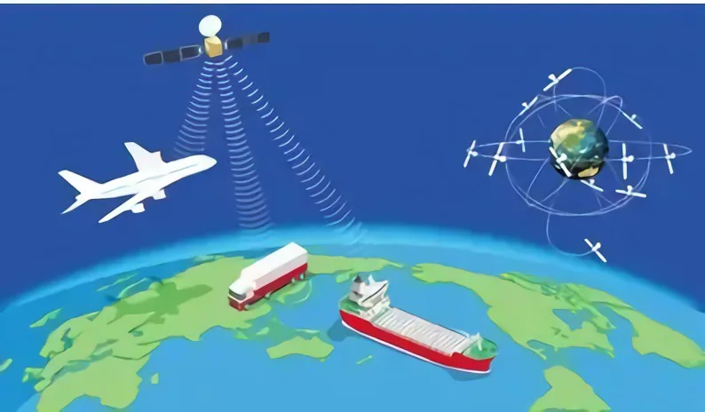
The BeiDou Navigation Satellite System
Being a navigation locating and communication system as well as independently set up by China, the BeiDou Navigation Satellite System represents the first generation of regional and three-dimensional satellite system with a source-tracking function. The system is comprised of 23 Earth-synchronized satellites, one central control station, multiple target calibration stations and a lot of user units. With the integration of the benefits of traditional astronomical navigation and locating as well as ground radio navigation and locating, the system creates a radio navigation station equivalent to the one set up in space.
The system can accomplish two-way message communication, and the communication data is primarily composed of two types: Chinese characters and codes. It is capable of identifying the geographical latitude, longitude as well as altitude for users at any time and any place, mainly offering navigation, locating, as well as timing for public security, highway traffic, railroad transportation and marine operations in the territory, territorial waters and neighboring areas of China. What’s more, short message communication services are also provided among users and between users and the central control station.
The BeiDou-2 Navigation Locating Satellite System
The BeiDou-2 Navigation Locating satellite System (BD2 or BeiDou-2) is a global satellite navigation system independently researched and developed by China. The BeiDou-2 is not a simply extended version of the BeiDou-1. Instead, it has been an optimized version based on the drawbacks of the BeiDou-1, offering global navigation locating services for all-rounded areas including the land, sea and air. It bears the similar functions of GPS in the United States and the Galileo satellite navigation system from the European Union. On April 30, 2012, China successfully launched “one rocket and two satellites” at the Xichang Satellite Launch Center. The twelfth and thirteenth BeiDou Navigation System satellites were successfully launched into the scheduled transfer orbit by a Long March 3B carrier rocket.
The third generation of the BeiDou Navigation Locating Satellite System
The BeiDou-3 global satellite navigation system (the BeiDou-3 system for short) is comprised of 24 medium circular Earth orbit satellites, three geostationary orbit satellites and three inclined geosynchronous orbit satellites, a total of 30 satellites.
The BeiDou-3 satellite navigation system supports 2 kinds of services, which is called the open service and the authorized service. The opened service functions as supporting free locating, speed measurement as well as time services in the service field with locating precision of ten meters, timing precision of 50 nanoseconds and speed measurement precision of 0.2 meters per second. The Authorized service functions by offering safer locating, speed detection, time and communication services and systematic integral information to the authorized user.
4. The application cases of the BeiDou System

Smart Driving
By using the 5G plus BeiDou locating system with high precision, a user is unnecessary to set up his or her own basic calibration stations. The user can acquire the national locating services with high precision with only an account or an SDK.
The vehicle-grade MU plus GNSS is equipped with tightly coupled solving algorithms to guarantee the constant locating of vehicles in complicated environments such as tunnels and urban canyons. 5G network high-bandwidth and low latency technologies are utilized to realize differential data interaction between vehicle equipment locating terminals and high-precision locating networks to guarantee high-precision location data security.
Intelligent Port and Shipping
In recent years, China’s shipping industry has achieved rapid growth but labor costs continue to soar and operational safety still needs to be improved.
The BeiDou system with 5G plus technology is able to support all-rounded as well as all-weather dynamic and static locating services in a precise and accurate manner for port and navigation scenarios such as port machines, collector trucks, personnel, beacons, ships and locks to enhance the operational efficiency, safety level and service quality of port and navigation infrastructure. High-precision locating systems are installed in various types of harbor and navigation production links, which can reasonably monitor and control collision risks and deviation risks. 5G networks can be rented in order to realize real-time contacts and connections between the remote center and the port and maritime operation sites, guaranteeing the timeliness and precision of equipment message transmission.
Smart Logistics
Inspection robots, logistics vehicles, cloud AGVs, high-definition video cameras and other equipment in the logistics operation process can be connected to the 5G private networks to achieve centimeter-level accurate and precise locating with the help of China Mobile’s 5G networks, the BeiDou high-precision locating system as well as a space-time information platform.
2.6G-band 5G base stations are able to ensure end-to-end service latency and achieve multi-slice bearing logistics business for logistics-specific business scenarios to guarantee the security, privacy, high speed and reliability of the proprietary monitoring network. An intelligent logistics platform is set up with multiple accesses, end-to-edge cloud collaboration, video networking, and edge artificial intelligence with the help of big data analysis and cloud services.
Smart Bus
Installed with terminals like intelligent driving controllers, BeiDou high-precision locating on the bus, accurate and precise vehicle location information can be acquired to develop in-depth guidance strategies in order to support functions such as vehicle energy-saving and safe passage in and out of stations and crosswalks. Multi-fusion sensors such as radar and cameras are deployed at road junctions to realize real-time fusion sensing and information dissemination of road events.
Bike Sharing
At present, ordinary satellite locating is mostly utilized in bike sharing. However, the locating system features poor locating precision and stability, which leads to poor user experience in finding and returning bicycles, low efficiency of enterprise operation and maintenance debugging as well as great difficulties in departmental supervision.
The high-precision locating service can enhance the locating precision of bicycles to sub-meter level and support functions such as electronic fences, trajectory tracking and security warning. What’s more, it provides billing based on time pool to realize unified billing for large batches of bikes and offer a convenient experience for users.
Precise & Accurate Navigation
The BeiDou high-precision locating system has been widely applicable for the areas of the fields of mass consumption, sharing economy and the livelihood of people. Among them, the locating precision of smartphones is around ten meters. What’s more, there are jump points and offsets, which cannot satisfy the demands of lane-level map navigation and precise taxi hailing.

The technologies are mainly comprised of Real Time Kinematic, Precise Point Locating, the Assisted BeiDou System, the BeiDou ground-based augmentation system as well as the BeiDou satellite-based augmentation system.
Real-Time Kinematic
RTK, or Real-Time Kinematic, has the following working principles: the receivers from the basic calibration station and the mobile station constantly monitor the movement of the satellite. The basic calibration station sends the real-time kinematic measurement value to the receivers from the mobile stations and the mobile stations realize the reception of the observed visual satellite signals at the same time. Then the basic calibration station will compare its own real-time kinematic measurement value with the received kinematic measurement value in real time to handle the data to calculate its own coordinates of the space so as to fulfill its own highly precise locating. The differences in the locating precision between the two kinematic measurement values can reach the centimeter level.
Precise Point Locating Technology
The Precise Point Locating Technology was first proposed by the U.S. Jet Propulsion Laboratory(JPL) Zumberge in 1997. The proposal as well as the realization of the technology have laid a foundation for the growth of the Difference Augmented Technology of the Commercial Global Satellite Station that is on the basis of the real-time Precise Point Locating Technology. With the integration of the benefits of GNSS standard single-point locating and relative locating, the Precise Point Locating Technology has developed into a new GNSS highly precise locating approach.
Assisted-BeiDou Fast Locating Technology
A-BDS, also named Assisted-BeiDou Locating Technology, is capable of enhancing the performance of the BeiDou Satellite Locating System. With the aid of the mobile communication operation base station, the Assisted-BeiDou Locating Technology is able to locate objects in a fast manner. The basic working principles of the Assisted-BeiDou Locating Technology lie in setting up several referred satellite locating receivers in the positions where there are excellent receiving results of the satellite signals. With the interaction between the Assisted-BeiDou Locating System servers and the terminals, a rough position of the terminals can be obtained. Then the auxiliary data such as ephemeris and clock needed by this terminal are sent to the terminal through the mobile network, and the terminal performs the BeiDou System locating measurement. The Assisted-BeiDou Locating Technology has distinctive strengths such as short locating time, low power consumption and high sensitivity.
The BeiDou ground-based augmentation system
The BeiDou ground-based augmentation system aims to establish a high-precision satellite navigation service system that is mainly based on the BeiDou system and compatible with other satellite navigation systems. With the use of BeiDou or GNSS high-precision receivers, it enhances real-time high-precision navigation and locating services in the service area for 1-2m, decimeter and centimeter-level through a network of ground-based reference stations and the broadcasting means of using satellite, mobile communication, digital broadcasting.
The BeiDou satellite-based augmentation system
The BeiDou satellite-based augmentation system remains a crucial component of BeiDou satellite navigation. Being equipped with satellite navigation augmentation signal transponders on geostationary satellites, it can broadcast ephemeris errors, satellite clock differences, ionospheric delays and other correction information to users to realize enhancement in locating the precision of the original satellite navigation system. The combination of the satellite-based augmentation system and the ground-based augmentation system are able to create a more efficient satellite navigation high-precision locating service network and set up a high-precision location service infrastructure environment for professional applications such as territorial mapping, marine survey, precision agriculture, disaster monitoring, unmanned aerial vehicles and unmanned vehicles, as well as popular applications such as car navigation.

Global Navigation Satellite System is a general term, which is included with the four navigation satellite systems covering Global Locating System, the GLONASS system, the GALILEO navigation system and the BeiDou system. What’s more, it also involves the MSAS system from Japan, GAGAN from India and NIG-GOMSAT-1 from Nigeria.
Therefore, GNSS functions as a star-rated radio navigation system utilizing the artificial satellite as the navigation station to provide all-weather, highly precise locations, speed and timing information for all kinds of military and civilian carriers on the land, sea, air and sky around the globe, which is also referred to as space-oriented locating, navigation and timing systems.
The most important feature of the “BeiDou” system lies in the close connection with navigation and communication, which is not available in other navigation systems. For example, the BeiDou system can play a crucial role in places such as deserts and grasslands, where cell phones cannot be utilized.
The BeiDou-3 system utilizes a triple-frequency signal, which is able to better eliminate the impact of the ionosphere, improve locating reliability, and enhance data pre-processing capabilities, thus greatly boosting the efficiency of fuzziness fixation.
The locating precision of the BeiDou system will be boosted to the level of 2.5 meters to 5 meters. Also with the initial service supported by the BeiDou ground-based augmentation system, it is able to support services at the meter, sub-meter, decimeter, and even centimeter levels.
7. What are the differences between GPS and the BeiDou satellite locating system?

The most eye-catching difference between GPS and the BeiDou satellite locating system is that GPS has not been equipped with the function of sending and receiving short text communication while the BeiDou satellite locating system supports the function of sending and receiving short text communication. However, it is vital to note that cell phones generally cannot support the function of sending and gathering texts of the BeiDou satellite locating system for the reason that the locating chip on the cell phones can only support obtaining locating information from satellites.
GPS utilizes a dual-frequency signal. However, the BeiDou satellite locating system takes use of a triple-frequency signal. Theoretically speaking, GPS has comparable locating precision globally while the locating precision of the BeiDou satellite system is specially strengthened for China and its surrounding areas.
GPS has actually been equipped with 32 satellites. The more satellites there are, the more redundant data will be obtained, the more reliable the data will be, and the smaller the DOP value will be. Right now, the BeiDou satellite locating system has been only equipped with sixteen satellites. The more satellites will be, the more observation data will be acquired, and the more evitable the precision will be enhanced.
GPS is one-way oriented, which means that the receiver can only gather the location signals and only know where you are. On the contrary, the BeiDou satellite locating system is two-way oriented, meaning that the system is able to transfer your position to your friends to let your friends know where you are while also receiving signals. In general, GPS and the BeiDou satellite locating system both function as navigation and locating systems but they make use of distinctive locating technologies and therefore have different locating ranges. The BeiDou navigation system is expected to be equipped with global locating and navigation functions by 2020. However, GPS is an all-weather locating system that covers areas around the world.
China has begun to conduct research on the technologies and plans of satellite navigation systems since 1970.
The engineering set-up of the BeiDou satellite navigation system was initiated in 1994.
Two Earth Static Orbital Satellites were launched and the relevant systems are set up to come into use in 2000. The functions like timing, and information transmission of China’s systems have been changed from the original Global Positioning System to the BeiDou satellite navigation system.
The engineering construction of the BeiDou-2 navigation system was launched in 2004.
By the end of 2012, fourteen satellites (including five geostationary orbit satellites, five inclined geosynchronous orbit satellites and four medium circular earth orbit satellites) were launched to form the relevant network. On the basis of the compatibility with the technical system of the BeiDou-1 system, the BeiDou-2 system is added with a passive locating system to provide locating, speed measurement, timing and short message communication services for users in the Asia-Pacific region.
The engineering construction of the BeiDou-3 navigation system was launched in 2009.
In 2018, China’s BeiDou-3 network formation was fully completed.
On June 23, 2020, China successfully launched the fifty-fifth navigation satellite of the BeiDou system, which marked the full construction of the deployment of the Beidou-3 worldwide satellite navigation system constellation.


: The Definitive Guide 2022")


